High-altitude trekking
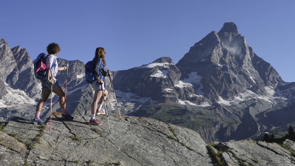
Trails for all levels in Breuil Cervinia and Valtournenche with the possibility to shorten the travel time thanks to the ski lifts, an excellent solution to reduce effort.
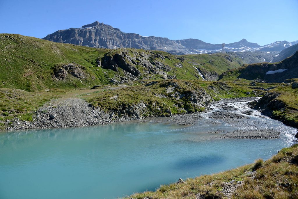
The starting point is almost always the famous Blue Lake (30 min. on foot from the town of Cervinia), the walk on flat ground is not difficult. From the Blue Lake, those with good endurance and legs can cross and reach Valtournenche from Alp Manda as far as Salette (2245 m arrival point of the Valtournenche gondola lift): grazing cows and a breathtaking view of the Grandes Murailles. The trail follows a section of the Grande Balconata, between the most popular trekking routes of the Aosta Valley.
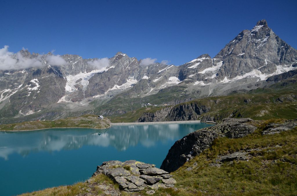
Always from Cervinia, climbing to Plan Maison, at a height of 2500 m, (from Breuil it can also be reached by the ski lifts and slopes, on the Cervinia-Plateau Rosà cable-car route), the choices are many, including the walk to the dam of Lake Goillet (2516 m, time 40 minutes: on the trail map it is indicated with n°.18). From here you can continue to Colle Superiore delle Cime Bianche, which can also be reached from Cervinia along the mythical Ventina ski slope, always with a view of the Matterhorn and Grandes Murailles.
Staying at Plan Maison, neuralgic centre and starting point for many walks, the tour as far as the Riondé shelter (www.rifugiorionde.it) is a must. Situated at 2802 m, right under the southern face of the Matterhorn, it is reached by following trail mark n°. 3 in 1hr 30 min., difficulty medium-easy. The shelter, named after the Duke of Abruzzi, has been fully restored and provides excellent dining facilities. It is the departure point for ascending the Matterhorn from the Italian side. You can also reach it from Cervinia following a comfortable unpaved road (trail mark 13). Along the route it is worth stopping for a moment at the Church of the Alpine troops, built in memory of the Battalion of Alpine Troops of the Matterhorn. It is also worth making a trip to and making a food stop at the Teodulo shelter (www.rifugioteodulo.it; 3316 m.), which acts as the divide between Valtournenche and Switzerland. It is reached by climbing along the route of the Plan Maison, Fornet and Bontadini chair lifts (trail 15, from Plan Maison, approx. 3 hours). From the shelter there is a view of the glacier of Plateau Rosà and of the mountains of the Valais, as well as the Matterhorn of course.
Remaining on the theme of shelters, the one of Plateau Rosà is known as the Shelter of the Guides (www.rifugioguidedelcervino.com) right at the arrival point of the cable car, comfortable for those who want to reach it without any effort; hikers can follow the options of the Ventina or Bontadini trails. From its terrace there is a magnificent view of the majestic 4000 m mountain of the Aosta Valley. Adjacent to the shelter stands Europe’s highest museum, “Una Montagna di Lavoro”, dedicated to the construction of the ski lifts and slopes of the Breuil basin. Another historical destination of Valtournenche, reached from Cervinia, is the Bobba shelter (2769 m). It is a demanding itinerary, especially in the final section, along the southern side of the Grandes Murailles, which takes right under Punta Budden. The trail starts close to the golf course and football pitch and is marked n°. 11 (travel time: 2 hours) on the map. You can return to the town on trail n° 10 in the direction of Alp Bayettes and Avouil village, continuing along Regional Road 46 (Chatillon-Cervinia).
Follow our adventures on Cervino Ski Paradise social media
Stay updated with our latest news
Sign up for the newsletter
P.IVA 00041720079 - REA Aosta:23540
Capitale Sociale: Deliberato € 54.600.546.00
Sottoscritto e versato € 54.600.546,00
©Cervino S.p.A - 2026